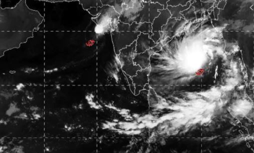
Kolkata: A cyclone formed over the Bay of Bengal is likely to intensify into a “very severe” cyclonic storm over the next two days and set to head towards the West Bengal and Bangladesh coasts, skirting Odisha, the Met department said on Thursday.
Cyclone ‘Bulbul’, which lay around 930 km south- southeast of Kolkata, “might turn into a severe cyclonic storm by Thursday midnight and further intensify into a very severe cyclonic storm by Saturday evening”, leading to rough sea conditions, Regional Met Director G K Das said.
Fishermen have been advised to return to the coast by Thursday evening and not venture into the seas till the caution was lifted.
“The storm is very likely to move north-northwestwards towards West Bengal and Bangladesh coasts,” Das said.
The maximum sustained windspeed within and around the area of cyclone ‘Bulbul’ had been recorded 70 to 80 km per hour, with gusts up to 90 kmph.
If the system intensified into a very severe cyclonic storm, the maximum sustained windspeed might reach 115 to 125 kmph, with gusts up to 140 kmph, the weatherman explained.
IMD Director General Mrutyunjay Mohapatra said the cyclonic system was being monitored to ascertain the direction of the storm and the possible location of its landfall.
The Met department has warned of heavy rainfall over the coastal districts of East Midnapore, North 24 Parganas and South 24 Parganas from November 9 to 11.
District officials have been asked to keep a tab on the situation and prepare for any contingency, a government functionary said.
According to the weatherman, West Bengal and Odisha coasts might experience squally wind with speed reaching up to 50 kmph from Friday evening, which might gradually increase thereafter.


