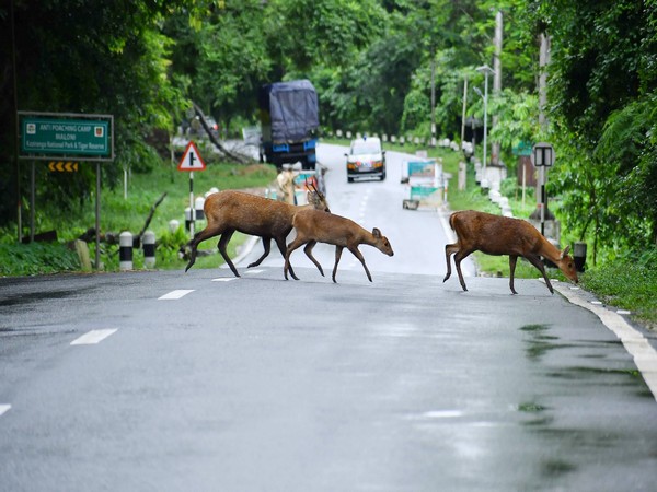
The Assam Police has permitted the movement of commercial vehicles during the daytime in the Kaziranga National Park area after the flood situation improved.
“Entry of commercial trucks are allowed to move in Kaziranga National Park area, without Piloting, in regulated speed from 05:00 AM to 06:00 PM. Commercial trucks are not allowed to enter Kaziranga National Park during the night hours (from 06:00 PM to 05:00 AM),” the order from the Assam Police read.
The ease of restrictions came after the flood situation in the state improved. Earlier, the administration had imposed some restrictions on vehicular movement on National Highway 715, which passes through Kaziranga National Park, in view of the floods and to ensure the safety of both humans and wildlife during this critical period.
Floods in Assam have claimed the lives of 214 animals in Kaziranga National Park so far, officials said, adding that 155 animals have been rescued.
As of Saturday, the water level at Passighat, Dibrugarh, Dhansirimukh and Tezpur is below the danger level. However, at Neamatighat and Numaligarh, it is above the danger level. There are 233 camps as of July 18, of which 12 are submerged.
The flood situation in Assam has claimed at least 91 lives across the state, the Assam State Disaster Management Authority (ASDMA) said earlier last week.
According to the Disaster Reporting and Information Management System (DRIMS), the Brahmaputra River in Neamatighat, Tezpur, and Dhubri, the Burhi Dihing tributary in Chenimari (Khowang), the Disang River in Nanglamuraghat, and the Kushiyara River in Karimganj were flowing above danger levels.
Twenty-one districts in the state were affected in the floods, including Cachar, Nalbari, Kamrup, Golaghat, Goalpara, Morigaon, Dibrugarh, Dhubri, Nagaon, Hailakandi, Dhemaji, Majuli, Sivasagar, South Salmara, Darrang, Karimganj, Barpeta, Kamrup (M), Biswanath, Chirang, and Jorhat.
A total of 2,406 villages were under 75 revenue circles and 32,924.32 hectares of crop area were under water


